India’s $10 Billion Maritime Gambit: The Great Nicobar Project Explained
The Great Nicobar Project is a massive ₹81,000 crore ($10 billion) infrastructure initiative by the Government of India aimed at transforming the southernmost island of the Andaman and Nicobar chain into a global maritime and strategic hub. At its core, the project features an International Container Transshipment Terminal (ICTT) at Galathea Bay, designed to capture a significant share of the cargo currently handled by regional giants like Singapore and Colombo. By leveraging its proximity—just 40 nautical miles—to the East-West international shipping route through the Malacca Strait, India aims to reduce its reliance on foreign ports while simultaneously strengthening its defense posture in the Indo-Pacific.
The Four Pillars of Development
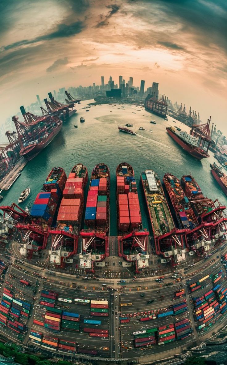
1. International Container Transshipment Terminal (ICTT)
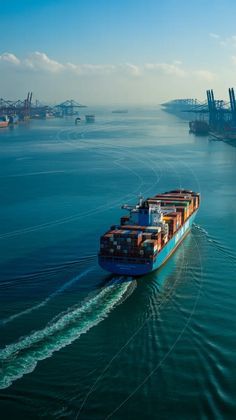
This is the “crown jewel” of the project, located at Galathea Bay. A transshipment port acts as a hub where cargo is moved from large “mother” vessels to smaller “feeder” ships.
- Depth Advantage: With a natural draught of over 20 meters, it can accommodate the world’s largest “Malaccamax” ships—vessels so large they can barely pass through the Strait of Malacca.
- Economic Capture: Currently, roughly 75% of India’s transshipped cargo is handled at ports outside India (like Colombo or Singapore). The ICTT aims to capture this revenue, potentially saving Indian exporters and importers hundreds of millions in forex and transit time.
- Phased Growth: The first phase is expected to handle 4 million TEUs (Twenty-foot Equivalent Units), eventually scaling to 14.2 million TEUs by completion.
2. Greenfield International Airport
Unlike the existing limited airstrips in the Andaman and Nicobar chain, this airport is being built from scratch with a focus on both high-volume tourism and strategic logistics.
- Strategic Location: It provides a critical “eye in the sky” over the East-West shipping lanes, allowing for rapid deployment of surveillance or defense assets if necessary.
- Dual-Use Capability: While it will serve the burgeoning smart city and tourism industry, it will also be equipped to handle heavy military transport and long-range maritime patrol aircraft.
- Future Capacity: The infrastructure is planned to eventually cater to 10 million passengers annually, turning the island into a regional aviation hub.
3. Gas and Solar Power Plant
A project of this scale requires immense energy, and since the island is isolated from the mainland power grid, it must be energy-independent.
- The 450 MVA Requirement: To power a massive port and a city of thousands, the government is building a hybrid power plant.
- Transition to Green Energy: While initial phases may rely on Gas-Based Power (LNG), there is a strong mandate to integrate Solar and other renewables to minimize the carbon footprint on this ecologically sensitive island.
- Micro-grid Technology: The project will likely utilize advanced micro-grid management to balance the fluctuating loads of a busy industrial port with the steady demand of a residential township.
4. Integrated Smart City (Township)
To support the port and airport, a massive influx of professionals, laborers, and service providers is expected. The township is the “human” element of the project.
- Population Projection: The city is designed to house a population that could eventually reach hundreds of thousands, a massive jump from the island’s current small population.
- Modern Infrastructure: It won’t be a traditional settlement; it is being marketed as a “Smart City,” featuring sustainable waste management, digital connectivity, and high-end healthcare and educational facilities.
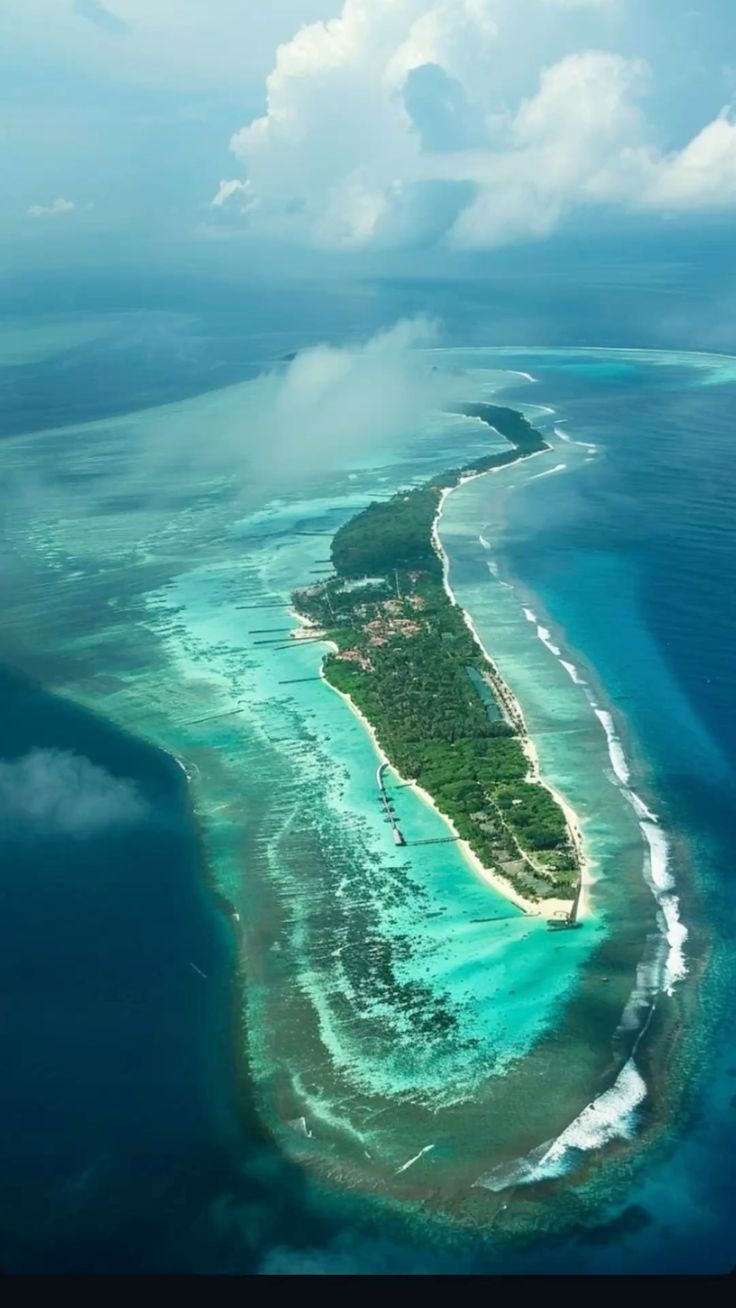
- Tourism Potential: Parts of the township are earmarked for eco-tourism and high-end coastal resorts, intended to rival destinations like the Maldives or Bali.

Strategic and Geopolitical Importance
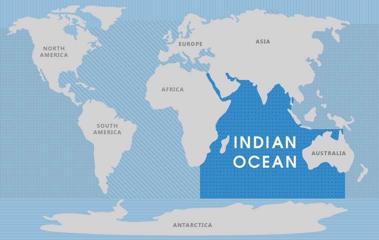
1. The "Malacca Dilemma" and the Great Nicobar Block
The “Malacca Dilemma” (a term coined by former Chinese President Hu Jintao) refers to China’s extreme vulnerability to a naval blockade in the Strait of Malacca.
- The Chokepoint: Over 80% of China’s oil imports and a massive chunk of its global trade pass through the narrow Malacca Strait. At its narrowest (the Phillips Channel), it is only 2.7 km wide.
- India’s Dominance: Great Nicobar is located at the very mouth of this strait (only 40 nautical miles away). By building a massive port and a dual-use military airport here, India gains the ability to “turn off the tap” for Chinese shipping.
- Surveillance & Strike: The project allows India to station long-range maritime patrol aircraft (like the P-8I Poseidon) and warships right at the entrance of the strait. In the event of a conflict (e.g., over the South China Sea or Ladakh), India could effectively interdict Chinese energy supplies, strangling their economy before the ships even reach the Pacific.
2. Can China Bypass the Malacca Strait?
China is desperately seeking “escape routes” to avoid this Indian and U.S. naval dominance. However, every alternative has massive strategic or economic “penalties.”
A. The Sunda and Lombok Straits (Indonesia)
These are the primary alternative water routes through the Indonesian archipelago.
- Disadvantages:
- Distance & Cost: Routing through the Lombok Strait adds approximately 1,500 miles and several days to the journey, significantly increasing fuel costs and shipping rates.
- Depth Issues: The Sunda Strait is shallow and hazardous for the Ultra Large Crude Carriers (ULCCs) that China uses for oil.
- Still Within Reach: Even if China uses these straits, they still have to pass through the broader Indian Ocean, where the Indian Navy and the Quad (India, US, Japan, Australia) maintain a high presence.
B. CPEC and the Myanmar Pipelines (Land Routes)
China has invested billions in the China-Pakistan Economic Corridor (CPEC) to Gwadar Port and pipelines through Myanmar.
- Disadvantages:
- Volume Limits: Pipelines can only carry a fraction of what a fleet of supertankers can transport.
- *Security Risks: These land routes pass through highly unstable regions (Balochistan in Pakistan and conflict zones in Myanmar), making them vulnerable to sabotage or local insurgencies.
- High Maintenance: Pumping oil over the Himalayas into Western China is an engineering nightmare and incredibly expensive compared to sea freight.
C. The Northern Sea Route (Arctic Route)
With the melting of Arctic ice, China is eyeing a “Polar Silk Road.”
- Disadvantages:
- Seasonality: It is only navigable for a few months a year (even with climate change).
- Cost: Ships require expensive ice-breaking escorts and specialized hulls, making it economically unviable for the majority of standard cargo.
- Russian Control: This route makes China entirely dependent on Russia’s goodwill and infrastructure, which is a strategic risk in itself.
Environmental and Social Concerns
The project has faced significant scrutiny regarding its ecological footprint:
- Deforestation: Estimates suggest that while 18.65 lakh trees exist in the diverted forest area, a maximum of 7.11 lakh to 9.64 lakh trees may be felled in phases through 2047 (Wikipedia, 2026; PIB, 2026).
- Wildlife Protection: Galathea Bay is a critical nesting site for the Giant Leatherback Turtle. Mitigation plans include coral translocation and long-term ecological monitoring (Earth.Org, 2026).
- Indigenous Rights: The project area overlaps with Tribal Reserves. However, the government has stated that the Shompen and Nicobarese tribes will not be displaced, and 76.98 sq. km of land is being re-notified as tribal reserve to compensate for the diverted land (PIB, 2026).
Global Port Landscape
The following table compares the projected capabilities of the Galathea Bay ICTT with existing world-class transshipment hubs.
| Feature | Galathea Bay (Great Nicobar) | Port of Singapore | Port of Colombo |
|---|---|---|---|
| Location Strategy | Proximity to Malacca Strait (40 nm) | Central Malacca Strait Hub | South Asian Transshipment |
| Capacity (Ultimate) | ~14.2–16.5 Million TEUs | ~37–45+ Million TEUs | ~7–10 Million TEUs |
| Natural Depth | >20 Meters | 16–18 Meters | 15–18 Meters |
| Primary Advantage | Strategic defense + Trade | Global logistics network | Proximity to Indian feeder ports |
| Operational Status | Phased Development (2025+) | Fully Operational / Expanding | Fully Operational / Expanding |
Conclusion & Future Outlook
The Great Nicobar Project represents a bold fusion of economic ambition and national security. While the “Great Nicobar Gamble” carries environmental risks, its success could redefine the economics of global maritime trade and solidify India’s role as the primary security provider in the Indian Ocean.
References
- Earth.Org. (2026). The Great Nicobar Gamble: Exploring the Hidden Toll of the $10 Billion Development Project.
- Great Nicobar Project - PIB. (2026). PIB Press Release.
- iBluu Corporations. (2026). Galathea Bay (Great Nicobar): India’s ₹41,000 Crore Bid to Break Singapore–Colombo Dominance.
- Wikipedia. (2026). Great Nicobar Island Development Project.